
In July, 2018, while ticking off Dorset’s remaining operational stations, the scout detrained at Wareham—which he’d used the previous year while en route to Swanage—and cycled through to Holton Heath.
He found a short cut along a footpath and came upon what was immediately apparent as a former government installation. A lot of this had become a trading estate so, with time in hand before the next train, the scout went in search of a catering van for a cup of coffee.
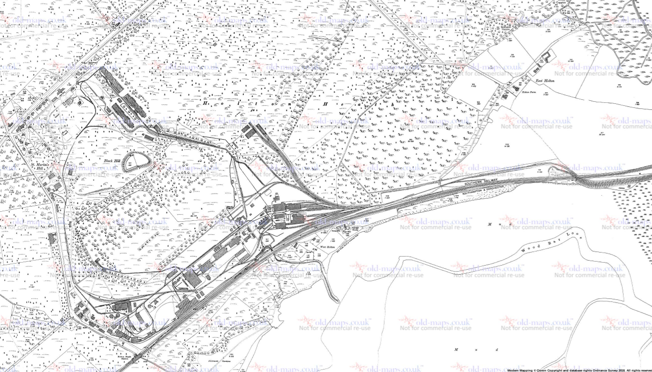
When he returned home, he found that he had actually been in the midst of the former Royal Navy Cordite Factory, built in 1914. The halt was opened to serve the factory. It was obviously a highly secure and sensitive site; in fact a decoy was built nearby during World War II. As a security measure, it never appeared on the O.S. “Popular” one-inch map.
It appears in its World War I form on the 1925 25 in. survey; vanishes back to heathland in 1954 (the 1936 survey is blank); and reappears in its post World War II form, shorn of its railways, on the 1970 survey.
Access to the complete set of 25 in. surveys held by “Old Maps” has been lost but this resource is available.
As well as its direct rail connection, a line continued alongside the Southern and crossed it to serve a jetty; the overbridge was only recently taken down. A network of standard and narrow gauge lines went in all directions. From Holton Heath Station to the northern tip of the site was well over a mile.
Little did the scout know, as he drank his coffee at a picnic bench beside an unfinished roundabout, that he was sitting on the course of the one of the ministry’s lines.